About King's River
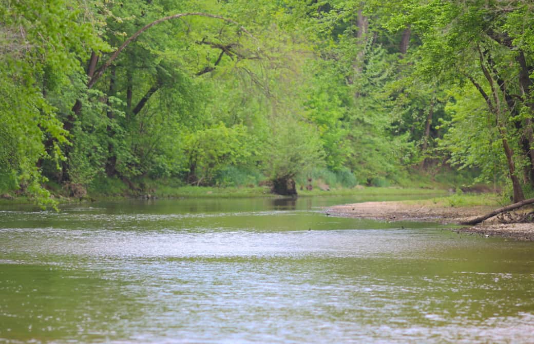
The Kings River is a ~90-mile, scenic Ozark mountain stream in Northwest Arkansas flowing from the Boston Mountains through Madison and Carroll counties into Table Rock Lake. Known for clear water, gravel bars, and scenic bluffs, it is a popular destination for smallmouth bass fishing, kayaking, and swimming.
Key Aspects of the Kings River:
Recreation: Popular for family-friendly float trips, swimming and bass fishing. There is no shortage of perfect gravel bars to recreate on.
Geography: It is a free-flowing, relatively shallow river featuring pools, riffles, and high limestone bluffs. The King's River is very unique and actually flows North!
Wildlife: The King's is home to a plethora of wildlife! Otters, bald eagles, great blue herons, various reptiles, catfish, small mouth bass, crayfish, and more!
http://www.kingsriverwatershed...
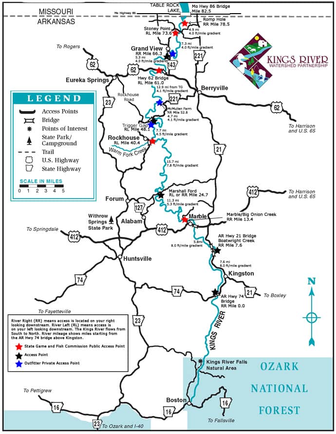
Access: Flowing more than 90 miles, there are several access points. Including public, private, and through outfitters. Riverside Resort is located directly next to the Highway 62 bridge access.
It is recommended that all boaters check water levels via the USGS website or by calling our office.
If water levels are too high or too low, we will call you prior to your reservation to cancel or reschedule.
Below is a map of the access points. Riverside Resort is located directly next to the 62 Bridge access.
Learn More at: kingsriverarkansas.com